NOAA Terminates Critical Satellite Data for Hurricane Tracking Amid Peak Season Concerns
NOAA Terminates Critical Satellite Data for Hurricane Tracking Amid Peak Season Concerns
Effective June 30, 2025, the National Oceanic and Atmospheric Administration (NOAA) is permanently ending the processing and distribution of data from the Special Sensor Microwave Imager Sounder (SSMIS). This decision comes as meteorologists enter the critical period of hurricane season, raising significant alarms among forecasters nationwide.
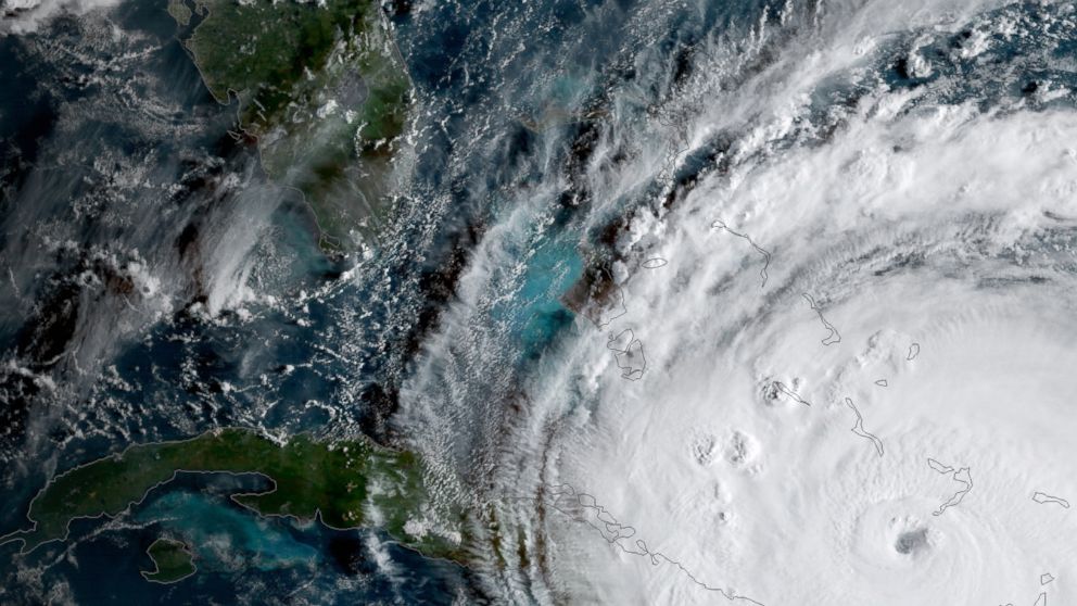
The SSMIS instruments, part of the Defense Meteorological Satellite Program (DMSP), are a vital tool that allows meteorologists to peer through dense cloud cover and examine the inner structure of tropical cyclones, including their precise center. Unlike other satellite imagery that captures only surface-level cloud tops and is ineffective in darkness or over open water, SSMIS provides crucial data for monitoring storm intensity and feeding accurate information into forecast models.
Scientists warn that losing SSMIS, which accounts for nearly half of all microwave instruments available, will severely degrade the accuracy and capabilities of hurricane forecasting. Experts like Michael Lowry, a hurricane specialist, assert that this discontinuation will “severely impede and degrade hurricane forecasts for this season and beyond.” Concerns are high that forecasters could miss rapidly intensifying tropical systems, particularly overnight, putting millions in hurricane-prone areas at greater risk.
While the Department of Defense states its internal users will still receive DMSP data, the public availability through NOAA is ceasing, prompting widespread concern from the scientific community about the immediate and long-term impacts on public safety and preparedness.
Disclaimer: This content is aggregated from public sources online. Please verify information independently. If you believe your rights have been infringed, contact us for removal.