Hurricane Erin Gains Strength, Approaches Leeward Islands as Category 1 Storm
Hurricane Erin Gains Strength, Approaches Leeward Islands as Category 1 Storm
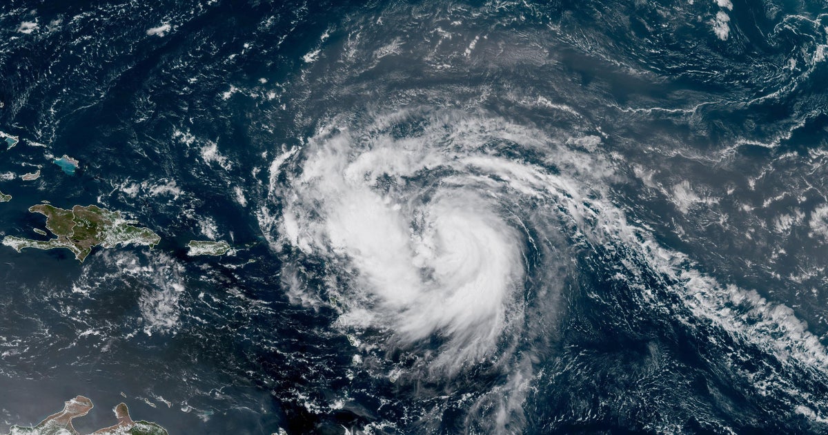
Hurricane Erin, the first hurricane of the 2025 Atlantic season, continued to strengthen Saturday morning as it approached the northern Leeward Islands. As of Friday afternoon, Erin was a Category 1 hurricane with maximum sustained winds of 75 mph, located approximately 415 miles east of the northern Leeward Islands, moving west-northwest at 17 mph.
Forecasters with the U.S. National Hurricane Center are urging residents across the Caribbean islands, particularly the northern Leewards stretching from the Virgin Islands to Guadeloupe, to closely monitor Erin’s progress. Tropical storm watches have been issued for several islands, warning of potential winds between 39 mph and 73 mph, along with heavy rainfall and life-threatening surf and rip current conditions. The U.S. Virgin Islands National Park Service announced closures for sites on St. Croix starting late Friday afternoon.
Maps show Hurricane Erin’s projected path curving northward, expected to pass near the northern Leewards on Saturday. While not currently forecast to impact the United States mainland, meteorologists are closely monitoring the storm. Erin is anticipated to continue gaining strength, potentially evolving into a major hurricane (Category 3 or higher) early next week, with some models suggesting it could reach Category 4 strength.
Disclaimer: This content is aggregated from public sources online. Please verify information independently. If you believe your rights have been infringed, contact us for removal.