Tropical Storm Jerry Intensifies, Leeward Islands Brace for High Surf and Flash Flooding
Tropical Storm Jerry Intensifies, Leeward Islands Brace for High Surf and Flash Flooding
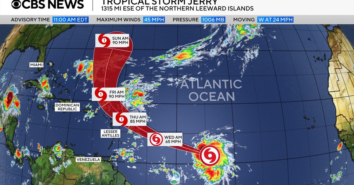
Tropical Storm Jerry, the tenth named storm of the 2025 hurricane season, continues its westward track across the central Atlantic this Wednesday, October 8th, after forming yesterday. Forecasters predict the storm will steadily strengthen and is expected to reach hurricane status within the next 24 hours.
As of Tuesday evening, Jerry packed maximum sustained winds of 50 mph and was moving at 25 mph. While still far from land, located over 1,300 miles east-southeast of the northern Leeward Islands, its potential impact on the Caribbean chain is a growing concern.
A tropical storm watch remains in effect for Barbuda, Anguilla, St. Kitts, Nevis, Montserrat, St. Barthelemy, Saint Martin, and Sint Maarten. The National Hurricane Center anticipates Jerry will be near or north of the northern Leewards by late Thursday or Friday. Although direct landfall is not currently expected, dangerous swells are forecast to reach the islands on Thursday, creating life-threatening surf and rip currents.
Residents in the Leeward Islands should prepare for significant rainfall, with up to 4 inches possible, carrying a risk of flash flooding. Authorities urge vigilance as the storm develops.
Disclaimer: This content is aggregated from public sources online. Please verify information independently. If you believe your rights have been infringed, contact us for removal.